
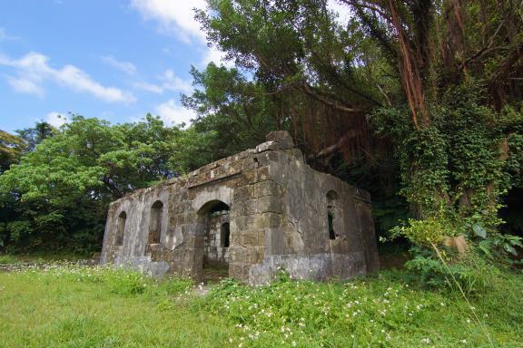
Located northeast of Keelung, on a mountain bordering Xinyi and Zhongzheng districts, Gangziliao Fort is a national historic site, along with Ershawan Fort and Dawulun Fort. The ruins are relatively well-preserved, including sentry posts, a lounge, barracks, a command post, bunkers, ammunition depots, and a mortar area, covering a considerable area. The fort features a 360-degree gun rail, allowing for free selection of firing angles—a unique feature among the five major mortar areas. Furthermore, the presence of a communication sluice between the observation platform and the mortar area is another distinctive characteristic.
Gangziliao Fort existed during the Qing Dynasty and, together with Baimiweng Fort, formed a defensive triangle protecting the outer harbor. Its fortifications were repaired during the Japanese occupation, and it was garrisoned after World War II. However, it was abandoned for many years until it was released to local government management a little over a decade ago. In terms of its historical and architectural value, it is no less significant than other historical forts.
Gangziliao Fort was built on the terrain of Gangziliao Mountain, facing the sea from the mountainside. It is strategically located at an altitude of 150 meters and covers an area of nearly 2 hectares. It mainly guards the waters north of Badouzi and Keelung Harbor, as well as the land route towards Ruifang. The name "Gangzi" is derived from the Ketagalan word for "trap," and "liao" is a Han Chinese addition meaning a place where people live together.
The Gangziliao Fort area is lush and verdant. Upon entering the fort area, follow the path uphill to find the semi-oval gun emplacements. Continue up the steps to reach a high vantage point offering panoramic views of Keelung Island, Heping Island, Badouzi, Bitoujiao, and other parts of the northern coast, as well as Jiufen and Jinguashi. The scenery is quite pleasant. On a clear day, you can even see Taipei 101.