
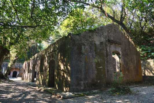
The Dawulun Fort is located northwest of Keelung, atop Dawulun Mountain behind Waimushan Fishing Port, above Lover's Lake. Due to its strategic location, it served as a crucial stronghold guarding the western side of Keelung Harbor. During the Opium Wars between China and Britain in 1840 and the Sino-French War in 1884, the Qing government stationed troops there. However, based on its structure and design features, it appears to have been rebuilt during the Japanese occupation.
The Dawulun Fortress, a national historic site, is situated atop Dawulun Mountain. Its strategic location, at an elevation of 231 meters, offers panoramic views: Lover's Lake to the west, Dawulun Bay to the north, and Keelung Harbor and the East China Sea to the east. The entrance to the fortress area is a gravel path shaded by fallen leaves. Upon reaching the fortress area at the summit, one can still see the fortress structure, gun emplacements, ammunition storage rooms, transport emplacements, and machinery ramps, all constructed of stacked stone blocks. Although the cannons are no longer present, clear traces of the gun mounts remain on the ground.
The Dawulun Fort ruins are well-preserved, including the camp gate walkway, cave barracks, east bastion, north bastion, south bastion, bomb shelter trenches, and water reservoirs. The area is quiet and verdant. Climbing the low wall of the ring road, one can enjoy panoramic views of Keelung Island, Wai Mu Shan Ao fishing village, Ba Dou Zi, and the beautiful scenery of the North Coast. It is a great place for sightseeing and conversation, and is also a popular choice for wedding photography, adding to its romantic atmosphere.